Suggested Trail Loops

There are plenty of places to explore in the Urban Wilderness. These are a couple of suggested trail loops to make your Urban Wilderness experience an adventure! 

The Battlefield Loop

600-acres of forest overlooking the Tennessee River in South Knoxville which includes historical, cultural and natural assets such as two civil war defense fortifications and a battlefield site; two naturally occurring lakes and a large quarry lake; as well as a 200’ high bluff overlooking the University of Tennessee and Tennessee River below.

Trailhead Parking & Directions: Click to the images below to find directions and trailhead parking at each of the designated areas. 

Explore Areas on the Battlefield Loop

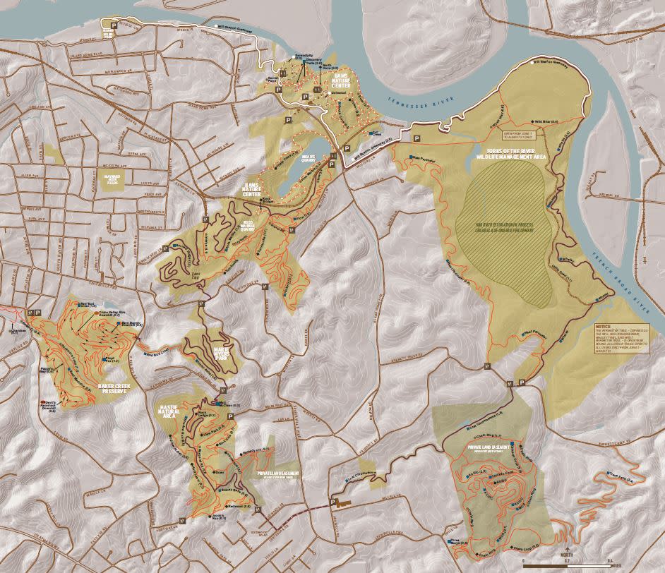
Battlefield Loop Trail Map

Battlefield Loop Map New


The South Loop

The signed, 12.5-mile South loop is a suggested route leading you through a unique experience connecting these areas, connecting The Quarries at Ijams Nature Center, Forks of the River Wildlife Management Area, the Helix Trails, William Hastie Natural Area, and Marie Myers Park.

Trailhead Parking & Directions: Click to the images below to find directions and trailhead parking at each of the designated areas. 

Explore Areas on the South Loop

Trail Map


Urban Wilderness Arrow  SOUTH LOOP ROUTE           

To follow the 12.5-mile South Loop route follow the UW logo, tree blazes, and street stencils.

South loop Map new

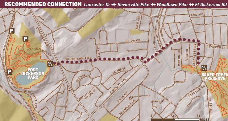
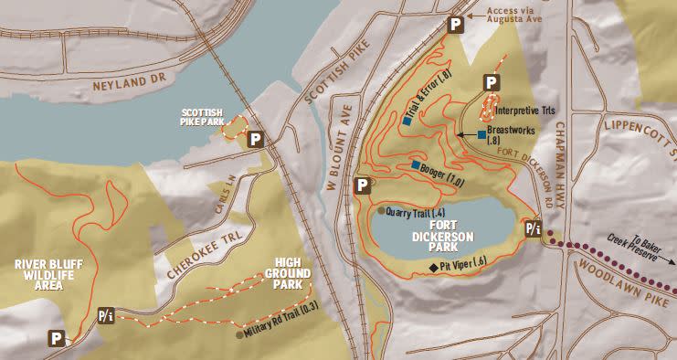
Baker Creek Preserve & Fort Dickerson Park Connection Route

Baker to Dickerson map